In 2021, Lyndon 'Bud' Brannigan, an architect and teacher, donated a collection of 111 photographs to the UQ Archives. The photos are of Brisbane’s inner-south in 1979 and were taken while he was a UQ student.
Enjoy this moment in time and retrace Bud’s photo-taking route from St Lucia into the City through this photo story by Jeff Rickertt.
About the photographs
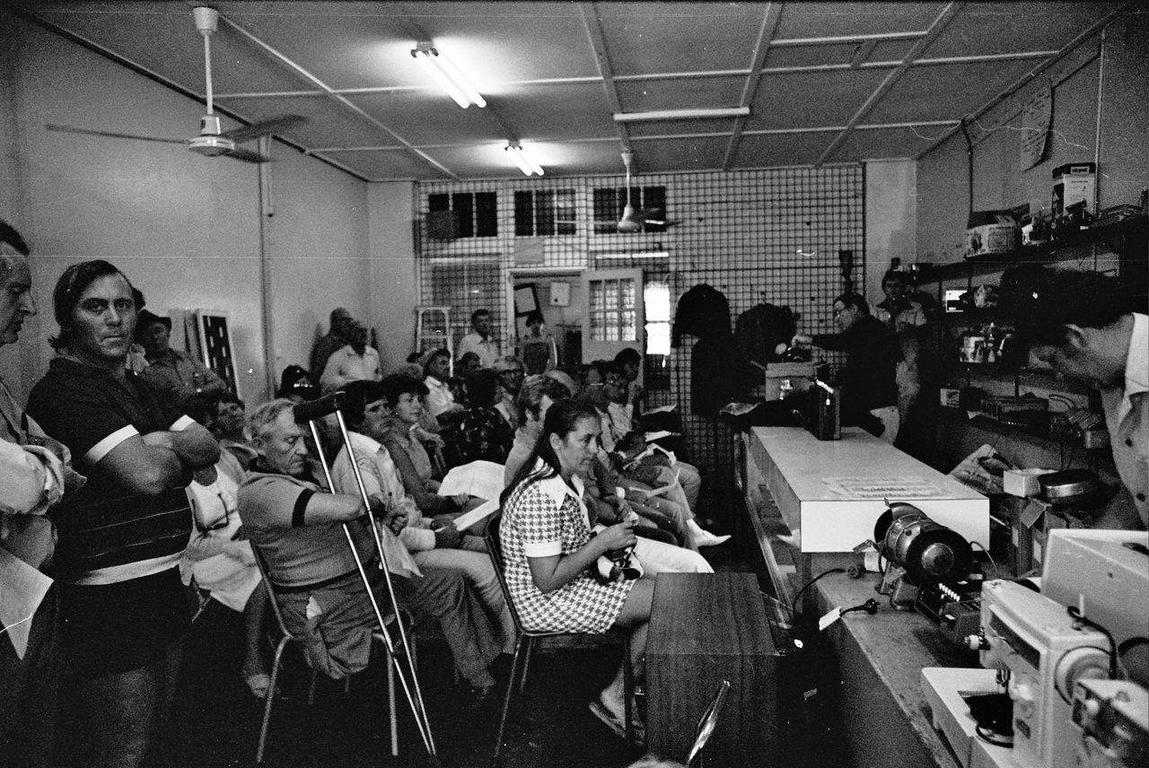
In September 1979 Bud Brannigan, a second-year UQ design student, was assigned a project to photograph the built environment of inner-city Brisbane.
He traversed the suburbs of St Lucia, West End, and parts of South Brisbane and the City on foot to photograph buildings, streetscapes, and urban life.
He also took a few pictures of Highgate Hill and Dutton Park, which were probably shot on the same day to finish the film.
Recreating Bud’s route
Using Bud’s photos, we can plot the route he took into the City.

Click for larger version.
He began on campus and headed through residential St Lucia, rode the cross-river ferry to Orleigh Park and then zig-zaged through West End and South Brisbane to the Victoria Bridge to cross the river again and finish outside the Supreme Court building in George Street.
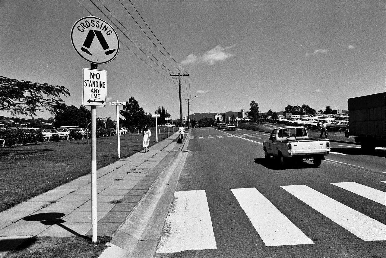
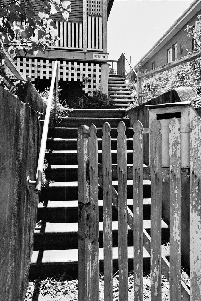
St Lucia
On the edge of campus, adjacent to today’s multi-story carparks, students could catch a lift at a dedicated hitchhiking zone with signposts to common destinations such as Toowong and the City.
Click for larger version.
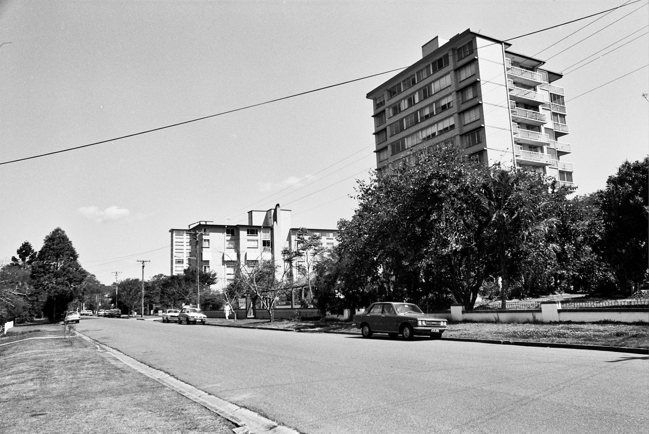
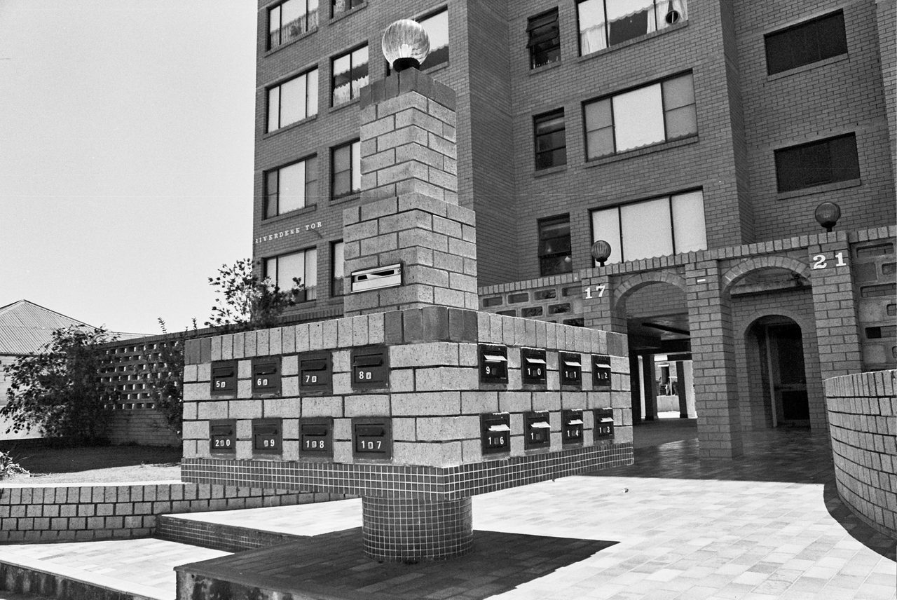
A few high rise apartment blocks rise from Macquarie Street, St Lucia, demanding our attention because of their novelty. Across the river apartment complexes such as Riverdene Tor, in Ganges Street, are only just beginning to challenge the dominance of Torbreck (the first high rise in Brisbane).
Click for larger version.
West End
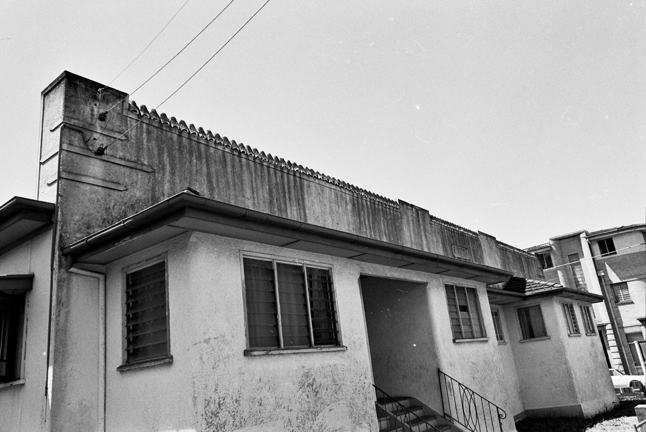
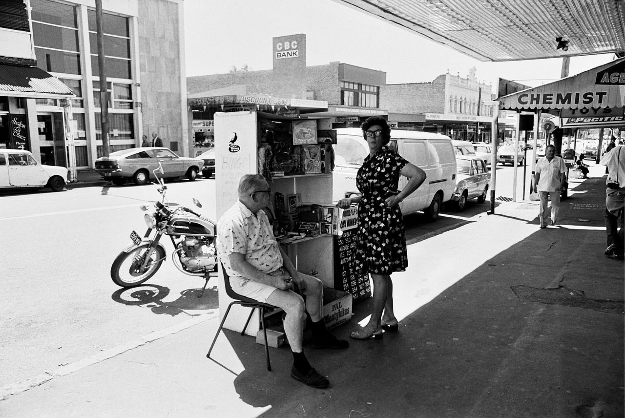
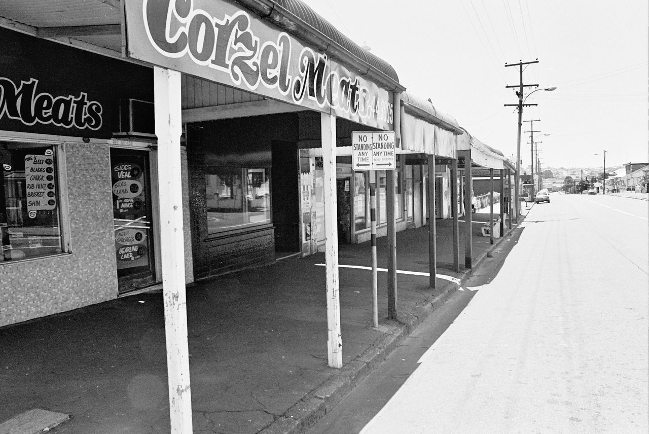
The main parts of West End and South Brisbane remain proudly working class, with aesthetic flourishes signaling the influence of generations of Greek settlement. Dwellings, some dating from the 19th century, are as eclectic in style and fabric as they are modest in scale.
Click for larger version.
Click for larger version.
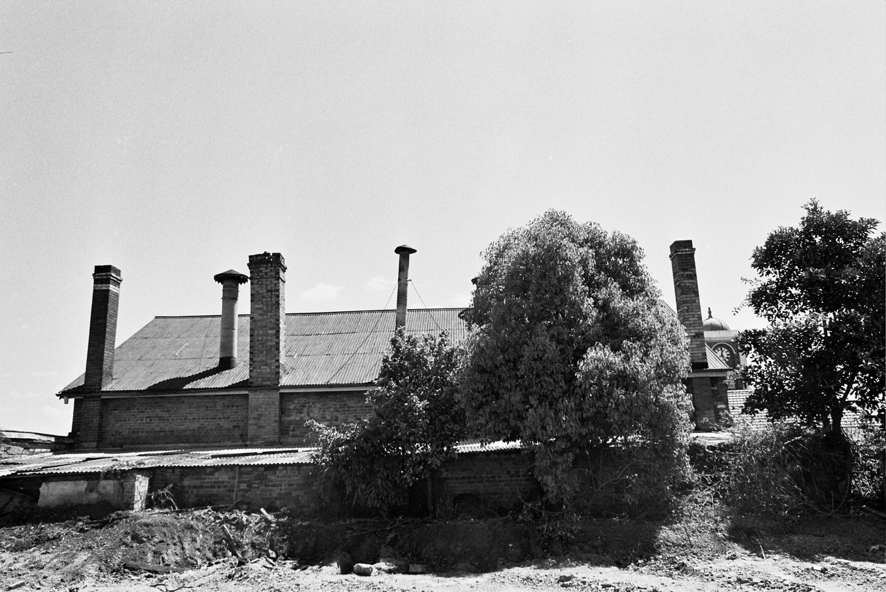
Many streets are barely more than laneways linking the thoroughfares of Hardgrave Road, Boundary Street and Vulture Street. Traffic congestion is unknown. Heavy industry still dominates Montague Road from Orleigh Park to Kurilpa Point and around the bend to the city reach of the river. But with new processing and manufacturing businesses now preferring the outer estates to the inner city, industrial West End is by 1979 beginning to wane.
Click for larger version.
Click for larger version.
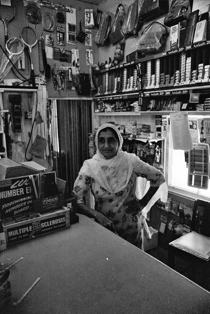
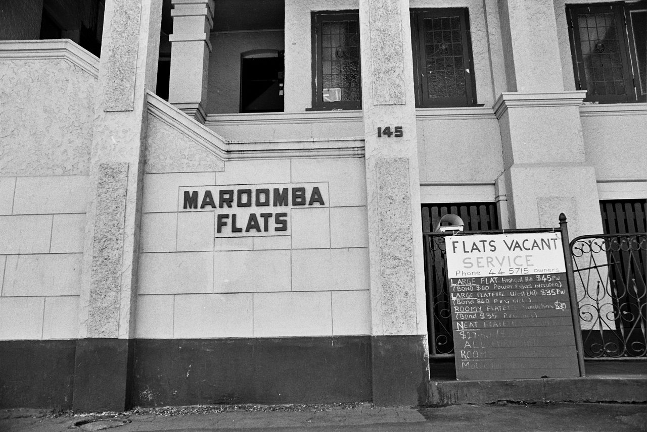
While established families and shopkeepers remain, the area’s cheap housing and proximity to the city and the university is attracting new populations of students and elements of the youth counterculture. The demography in 1979 may be shifting but the class composition is not. Gentrification is decades away. A three-bedroom chamferboard dwelling in West End (with new linoleum and paint and a separate toilet!) can be purchased for under $26,000, slightly over twice the national average yearly earnings of $12,000. A room in a local boarding house costs $17.00 per week, and a one-bedroom furnished and self-contained flat rents for around $40.00. A pawn shop still attracts plenty of business.
Click for larger version.
Click for larger version.
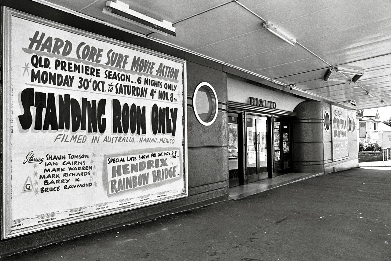
The social and retail centre of West End in 1979, as now, is the shopping strip along Boundary Street. As if compensating for its inability to compete, a smaller strip of shops on Hardgrave Road boasts the resplendent Art Deco Rialto Theatre.
Click for larger version.
Click for larger version.
Click for larger version.
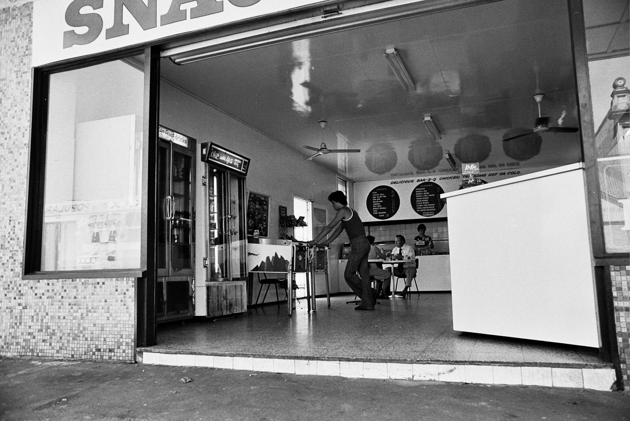
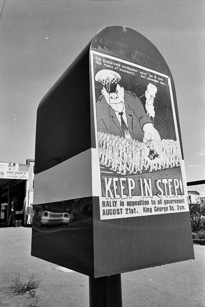
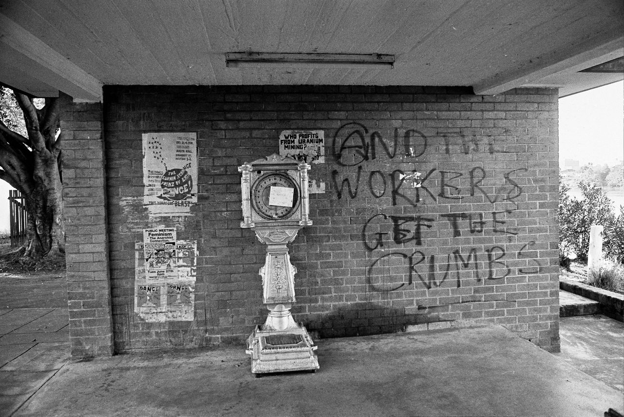
Discrete takeaway and corner shops service the more isolated pockets of the neighbourhood. It is an era of pinball machines, cigarette advertisements and political postering. Uranium mining and the right to protest are the issues of the day. People buy newspapers and study the form guide.
Click for larger version.
Click for larger version.
Looking through Brannigan’s images today, a careful observer can identify extant buildings and sites. But the surviving structures can only hint at the working class origins of their environment.
Click for larger version.
Photos that captured a place in time
In 1979 the young UQ design student was interested in the textures, styles and moods of place. In his photography he managed, accidentally, to capture time as well.
Bud graduated with First Class Honours from UQ’s architecture school in 1985, and has excelled as both an architectural teacher and practitioner.
With his recent gift to the university, he has augmented his legacy with a remarkable visual record of a Brisbane we can’t quite recognise any more.
View selected images from the Bud Brannigan series via UQ eSpace.